Welcome to our Adventure!

Al and I are thrilled that you have found your way to our blog. We hope you enjoy reading our journal and viewing our photographs of the natural wonder of our United States of America. Let's hit the road together!
Homer, Alaska

Monday, May 19, 2014

Simply Oustanding

Our arrival in Torrey Utah last week introduced us early to the outstanding beauty of the area. As you drive down scenic highway 24 you are taken right through 14 miles of Capitol Reef National Park, noted as one of "the best National Parks you've never visited". As if the drive on Hwy 24 wasn't pretty enough after you get to Hanksville, just before you reach the National Park section there's a sign that states "Scenic Views next 14 miles"; seriously, like the view wasn't already scenic??

We stayed at Thousand Lakes RV Park at the west end of Torrey. We've read of a few other bloggers staying here when in the area, and we enjoyed this campground as well. While we did not avail ourselves of the myriad of services available here, it was clean, quiet and very friendly. Dry and dusty, but what else can you expect? There area a few patches of grass, though, and a very nice pool if you are so inclined.

Touring Capitol Reef National Park was our first day's activity. A stop at the Visitor Center gave us the required maps and information needed for not just that day but the next few days.We also watched the short movie which gave a nice overview of the park. We then decided to do the 16 mile long scenic drive, then visit the different overlook areas in the park.

The scenic drive starts out behind the Visitor Center, and goes through part of the Historic Fruita area. Fruita was settled by the Latter-day Saints (Mormons) beginning in 1880. Fruita is situated at the confluence of Sulpher Creek and the Fremont River, both perennial water sources. The mild temperature in the area and the continuous water source made the location ideal for growing fruit trees, of all things. Acres of orchards were planted and thrived, right up to modern times. There are still 15 orchards in the park containing cherry, peach, pear, apple, plum, mulberry, almond and walnut trees. The National Park continues to maintain these orchards, and guests are invited to stroll the orchards and even sample fruit in season.

The Gifford Homestead has been renovated to contain a small museum and gift shop, featuring baked goods of the pioneer era. I can personally attest that the fruit pies (specifically peach) made from the harvest of the orchards are outstanding!!

We have been introduced to a term we've never heard until we arrived at Capitol Reef N.P.; Waterpocket Fold. The scenic road follows the western face of the Waterpocket Fold, and is a portion of the original road first used by Native Americans, then developed into a wagon road by the Mormon settlers around 1884.

Ok what is a "waterpocket fold"? It's a giant buckle in the Earth's crust, over 100 miles long, created over 65 million years ago. Many layers of originally horizontal sedimentary rock make up the fold. The layers formed from sediments deposited over hundreds of millions of years in seas, tidal flats deserts and other ancient environments. Regional "lifting" of the deep fault occurred, with the west side of the fold being lifted more than 7,000 feet higher than the east side of the fold. Waterpockets are the basins that form in many of the sandstone layers as they are eroded by water. These basins are common throughout the fold giving the reason behind the name Waterpocket Fold. Here is a good view of the Fold from the Strike Valley Overlook (we tried to get there but needed a high clearance vehicle, drat!).

There are two spur dirt roads off the scenic drive which can be taken, and lead to trails at the end of each canyon for further exploration. However, as dogs are still being discriminated against in National Parks, we had to leave the hiking for a different day. 

This is looking up at the cliff walls from inside our SUV. It's really up there!

Desert "varnish" dripping down the cliffs. 

These last few pictures were taken in the Grand Wash area of the scenic drive, the first spur road.

There's been a lot of color in the desert surprising me. All kinds of flowers, in blues, yellows, oranges and white.

We then headed to the end of the drive, and drove into the Capitol Gorge spur road. I was looking for Bighorn Sheep here, but no luck.

The constantly changing colors and designs of the canyon walls are striking.

There was a picnic pavilion at the end of the spur road, which seemed like a good place to stop and have lunch. We hung out with some other dog owners who couldn't walk the trail to an area called "The Tanks". natural cavities in the sandstone that capture rainwater similar to the pockets for which the Fold is named.

We headed back down the scenic drive, and got back on Hwy 24 to hit the overlook areas. The brochures said to allow 90 minutes for the scenic drive; I think we spent 3 hours!!

The Navajo Dome, one of the prominent white domes featured in Capitol Reef N.P., is said to be the reason behind the "Capitol" portion of the Park's name. It is said that it reminded the early explorers of Washington, DC's Capitol building.

Goosenecks Overlook. Sulpher Creek flows through here, at one time being a low-lying plain area. As the fold began buckling, and the land warped upward, the stream was trapped in it's channel. The water began slicing through the sandstone creating an even deeper and curving channel. Where channels loop around close it becomes what is known as a gooseneck.

Chimney Rock

Inspiration Point...yeah, I'd say it's inspiring!

It was a very good start to our stay in Torrey. Beautiful day, beautiful scenery, and more adventures to come.

Friday, May 16, 2014

Cortez Colorado Activities

We are now in Torrey Utah, a few miles away from the entrance to Capitol Reef National Park. As if I need an excuse for being behind on the blog, :-),  my Verizon jetpack is completely useless here; no signal whatsoever. I was able to briefly hook up to the campground wireless, but it was sketchy at best. I am able to use my iphone's ATT, which has full bar 4G service, as a hotspot, but with a very low data plan I needed to make sure I wasn't using too much before doing pictures and a blog.

Leaving Santa Fe we traveled diagonally northwest towards the Four Corners area: the spot where New Mexico, Arizona, Colorado and Utah all meet. 275 miles from Santa Fe was the town of Cortez CO and it seemed like a good spot to stop for a few days before my reservations in Utah came up. We were on I25 for a short distance, then an astoundingly beautiful drive along US550  north-northwest to Durango CO. It was a good one/two lane highway all the way, no harsh passes to go over, just one smaller down pass as you head into Durango. It was wonderful being back in Colorado and seeing those mountains again! From Durango it's about another hour on US160 right into Cortez. We stayed at the Cortez/Mesa Verde KOA, and it was really nice. I had tried contacting two other campgrounds in the area, leaving messages about a reservation. Neither ever returned my message, and they were all in the same price range, so I went with the KOA and was very happy I did. We had a beautiful view of Mesa Verde from our big picture window, a beautiful mile long dog walk around a pond, and we were right next to a huge dog park run by the town. I can definitely recommend staying here if you are in the area. It had very clean laundry facilities, was close to a brand new CitiMarket grocery store (where once again we scored with Boarshead cold cuts and loaded up before leaving), and pretty close to the activities we had planned.

Our first day there we headed to the Anasazi Heritage Center located just south of Dolores CO. 


The Anasazi Heritage Center houses a wonderful museum, teeming with exhibits and demonstrations of the life of the Ancestral Puebloan people found through meticulous excavation all throughout the Four Corners area.


There is also a traveling exhibit hall, and the presentation right now is on the mountain lion. It, too, was very interesting, especially the video on how to protect yourself if you find yourself being stalked by one!

This building is also headquarters for one of the newer National Monuments, Canyons of the Ancients. This park is pretty much undeveloped, being run as an "outdoor museum concept". This allows visitors to experience cultural and natural resources through self-discovery. The park's sites are pretty far apart, and there are no facilities and very few interpretive materials. There are roads between the sites, but they are gravel and/or dirt.

Our first stop was 28 miles from the Anasazi Cultural Center, Lowry Pueblo.

Lowry Pueblo is a 1,000 year old Ancestral Puebloan village that is named after the homesteader who found it in the early 20th century, George Lowry.

Lowry Pueblo is a bit difficult to photograph, as the main portion of the dwelling has been covered by a roof, protecting it from further deterioration. 

Our next destination was Painted Hand Pueblo, about 30 miles away from Lowry Pueblo. Along the route we had good views of Sleeping Ute Mountain, the subject of  Ute Indian legend.

Painted Hand Pueblo turned into our more interesting part of the day. The pueblo was down below the rim of the cliff. It was a short hike to this point, and then it seemed like the direction sign was pointing for us to go straight down....I don't think so!

Al scouted around a bit and found the trail leading down further up the rim. There was still some rock scrambling to do, but at least not vertically down the cliff :-).

The tower building from below, rather than looking down on it.

The overhang in which they feel the main living area was in...

and the feature that gives the name to the pueblo...can you see the two blue-outlined hand prints?

After climbing back up to the rim, we headed down the road another 30 miles to Hovenweep National Monument. 

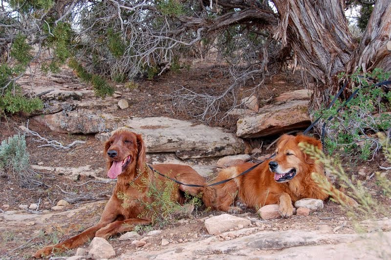
Casey and Honey like the National Monuments, where they are usually allowed to join us on the trails, much better than the National Parks.

We hiked the 2 mile rim trail to view the Square Tower group of buildings.

There are several ancient pueblo buildings here....I captured four different ones in this picture.

Many dwellings stand right on the canyon rim and others were actually built on top of isolated or irregular boulders, like the structure above. Not a practical site for safety or access! Most of these locations are located near springs and seeps and suggest the Ancestral Puebloans were protecting their water sources.

Resting in the shade before beginning our descent 100 feet down to the canyon floor...

and then back up to the Visitor Center. It was an interesting day of exploration, and gathered two more stamps in the National Park passport!

The next day, the day before winter storm Zephyr was forecast to hit the area, we visited Mesa Verde National Park. We had visited this park for the first time in 2012 while spending the summer in Colorado, but there were a couple of things we missed, being time-constrained because we had to put the dogs in doggie daycare in Durango for our visit. Since then, the new Visitor's Center has opened, and it is just beautiful.

Spruce Tree House, the best-preserved cliff dwelling on site is a self-guided walking tour that we missed on our previous visit. Round-trip distance is short, about 1/2 mile, but steep. 

The alcove is 216 feet long and 89 feet deep, housed 120 rooms, 10 associated ledge rooms, 8 kivas and two towers.. The estimated population is thought to be 60-90 people, comprising 19 separate families.

Spruce Tree House is considered the best preserved cliff dwelling in Mesa Verde, with many intact walls and roofs, wooden beams and plastered walls. The entire complex is original construction from the AD 1200's with the exception of the central portion of the two-story wall behind this kiva. It had partially collapsed into the kiva, and excavation and stabilization efforts in 1908 replaced the fallen section to prevent further collapse.

Two other areas we explored this day were the Chapin Mesa Archaeological Museum  and the Far View Sites. After that we headed back down the mesa ( it's a 21-mile drive up the mesa from the Visitor's Center entrance to the first of the exhibits.)

Sunday was a hunker down day; it was supposed to be cold, windy, rainy with the possibility of snow showers. Although it was far better than the several inches of snow forecast for areas immediately north of us, it didn't sound great for going out and doing anything! It was actually quite productive, as we got laundry and shopping done, stocked up for our week coming up in Torrey UT (no close facilities for any type of major grocery shopping), and did some cooking as well: soup, homemade tomato sauce and some pre-cooked meals. Al watched some golf, and then we watched the newest Hobbit movie, The Desolation of Smaug.

Monday's weather still wasn't fantastic, but we decided to take a hike in Sand Canyon, the last section of Canyons of the Ancients National Monument. It started out cloudy, but the sun finally broke through.

The scenery was beautiful, and here's another cliff dwelling for your viewing pleasure!

As we hiked, I found what I believe to be yucca plants in different stages of bloom. In fact, the amount of wildflowers here in the desert has amazed me.

The cactus is all starting to bloom as well. 

The scenery was just amazing. The entire hike, one way, is 6 miles. We did not do that :-). In speaking to people it was recommended if you have two vehicles to park one at the trail head we started at, then drive to the trail head at the north end. Then it's a 6 mile hike, BUT it is mostly all downhill, which is a much better direction to be going :-).

I know this was long, and I appreciate the perseverance of anyone who slogged through to the end. This brought to an end our stay in Cortez, and we headed out Tuesday morning towards Torrey Utah. It was an easy ride up US 491 to US 191. As we headed towards Moab the red rock scenery became drop dead beautiful! After a short journey on I70 (why oh why are the Interstates so much nicer out here than in the East??), we exited onto Hwy. 24 to Torrey. It was one point so far where I have regretted driving behind; it was hard to pay attention to the road when your head is swiveling trying to take it all in! And that, my dear readers, will be the subject of my next chapter.