Welcome to our Adventure!

Al and I are thrilled that you have found your way to our blog. We hope you enjoy reading our journal and viewing our photographs of the natural wonder of our United States of America. Let's hit the road together!
Homer, Alaska

Friday, April 29, 2011

We're Back On-Line!

Warning: Long post ahead :-)!
Sunday April 26
This is our third day here in Hocking Hills S.P. in Ohio, and as seems to be the norm, we awoke to the steady drumming of rain on the roof. From what we can see on the radar, there's a front stalled across the area and the rain and storms are just hanging right through here. It hasn't been nearly as bad as further south, where the storms have been quite severe along with tornados, but it still isn't making for a pleasant experience.
I know...my home has wheels on it, why don't I move? Well, we are reporting to our workamping job on Thursday, and in looking at the forecast the weather isn't any better anywhere between here and there. By Thursday when we're scheduled to move to Waldenwoods, the rain forecast is only 30%, so we stand a chance of at least packing up and driving without getting too wet. The weather radio keeps going off, but it's for flooding, and we're quite high enough that we don't have to worry about that.

Our campsite at Hocking Hills S.P.

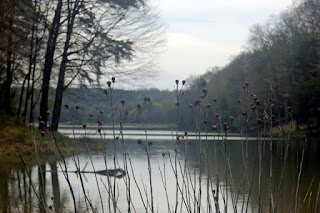
Rose Lake, a short hike behind the campground.
The Hocking Hills region of Ohio is very interesting. I never expected to see anything like it here. I always pictured Ohio as pretty flat and farm-like. There are many farms here, but it is on rolling hillsides. There are massive sandstone outcroppings, deep cool gorges, towering hemlocks and dozens of waterfalls....and yes, all the rain is making for beautiful waterfalls! All of the features of the park have been carved into the Blackhand sandstone by natural erosion and weathering. This Blackhand sandstone is more than 150 feet thick in the park area, and is divided into three layers. The upper and lower layers are firmly cemented and very resistant to weathering, where the middle layer, where you find the rock shelters, caves and recesses, are loosely cemented and easily weathered. Water is the primary erosion agent between freezing and thawing, and the wind also plays a factor.

There are six separate areas to this 2,000 acre park: Old Man's Cave, Cedar Falls, Ash Cave, Conkles Hollow, Rock House, and Cantwell Cliffs. The campground is in the Old Man's Cave area, and was quite the climb up! The park is then surrounded by another 9.238 acres of land comprising the Hocking State Forest. So we really are out in the middle of nowhere :-). The drives along the various roadways are beautiful, and many are part of the Ohio Scenic Byways system of roads.

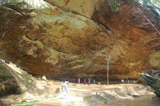
Saturday we did catch a break in the weather; the skies cleared, and we bolted out to see some of the sights. We had about a three hour window before the rains were due to come back to the area. We decided to go to Ash Cave first. It's about 4 miles or so from the campground to the southeast. Ash Cave is the largest, most impressive recess cave in Ohio.

Neat little cave system enroute to Ash cave...looks like a face to me!

We took the middle approach to the cave, which goes through a narrow gorge lined by hemlocks massive beech trees, and other hardwood trees. It's about a quarter-mile walk through the gorge when it suddenly opens into the massive recess known as Ash cave. It measures 700 feet from end to end, 100 feet deep from the rear cave wall to the front edge and the rime rises 90 feet high. There's an awesome waterfall coming off this rim, with 3 distinct falls of water today. Ash Cave was named for the huge piles of ashes found under the shelter by early settlers. The largest pile was recorded as 100 feet wide by 30 feet wide and 3 feet deep. The source of ashes is unknown, but believed to be from Indian campfires built over hundreds of years.
Recent uses of the caves, besides tourism, consisted of being used for camp and township meetings, Sunday worship services, weddings, and many large group gatherings.

Ash Cave

Waterfalls at Ash Cave

Looking at Ash Cave from behind the waterfalls

We still had plenty of time, so we headed for Cantwell Cliffs, in the northeast section of the park. The erosion caused by Buck Run accounts for the deep valley, steep cliffs and rock shelters under the cliffs. It was really a most interesting hike, with a lot of up and down. Once again, I will say our hills are nowhere near the hills out here! We started out on the red trail, which follows the rim of the gorge , and after descending down into the valley to catch the waterfalls at the bottom, we continued to follow the yellow trail back to the parking lot. There were many steps up and down, a few really narrow spaces, and a couple of stream crossing where we had to hop across rocks to cross. Due to the recent rainfall, the waterfalls here were also very full, and the trails were quite messy as well. The pups had no issues however, although Chelsea wasn't too thrilled with a couple of the tighter squeezes. They are, however, becoming very fond of the pools at the bottom of the waterfalls, where they can grab a drink of fresh water and plunge in for a quick cool off :-).

Headed down to the Rim Trail at Cantwell Cliffs


Part of trail known as "Fat Woman's Squeeze". I really liked the colors when the sun hit this.


They couldn't wait to get to the pool!

Sunday we did get a short break in the middle of the day. The sun never came out, but it stopped raining long enough for us to grab the leashes and go to the 2 closest areas. Cedar Falls is about 2 miles from the campground, and we went there first. It's a 1/2 mile walk to the base of the falls from the parking area, then loops around and comes back up the gorge at the other end of the parking lot. Even with hiking boots, though, the trail after the falls was so mucky, we just didn't want to attempt it, knowing the frightfully muddy mess that the dogs would be. But Cedar Falls itself was awesome, its the greatest waterfall in terms of volume in the Hocking Hills region. In the mid 1800s, a gristmill was built above the falls to utilize the water power for grinding grain, but nothing now remains of it. It did not disappoint us, either! We have decided to make the best of this lousy weather, after all, we can't change it, so we look at it this way: the enormous amounts of rainfall are creating some spectacular scenery for us to look at! :-)

Cedar Falls

The water was swirling really fast around this rock; you can see how the rocks erode from the motion.

Casey earning his mountain goat nickname

If anyone notices in the pictures, which I didn't until I read it, Cedar Falls was actually named as a mistake; people mistook the stately hemlocks for cedar trees. I never knew hemlocks looked that close to cedars; as Al said, guess we have to get a plant/tree identifier book to go with the bird book :-).

We then went to Old Man's Cave area, which is at the base of the campground. This is by far the most popular area in the park, and we could see that from the huge parking lots and the number of cars there! The Grandma Gatewood Trail begins here, a six-mile hike connecting three of the park's most popular areas, Old man's Cave to Cedar Falls to Ash Cave.. This trail has been designated as part of Ohio's Buckeye Trail as well as part od two national systems- the North Country Scenic Trail and America's Discovery Trail.
Our agenda here was to start at the Upper falls area, and make our way along the gorge as far as we could until the rain started. We didn't get very far! About 15 minutes after we arrived, the raindrops started, so we just got a few pictures of the Upper Falls and pool. So we headed back to the trailer, and watched "Lord of the Rings" as our Easter day movie. Luckily the rain didn't affect the satellite dish to badly, and we were able to watch the Amazing Race.

Upper Falls at Old Man's Cave

Monday was halfway clear by midmorning, and we returned to Old Man's Cave to do the entire trail. Old Man's Cave derives its name from the hermit Richard Rowe who lived in the large recess cave of the gorge. He and his two dogs traveled through Ohio along the Scioto River in search of game. On a side trip up Salt Creek, he found the Hocking region, and this cave. He lived the rest of his life in this area and is believed to be buried beneath the ledge of the main recess cave.

The Old Man's Cave area is divided into five sections: Upper Falls, Upper Gorge, Middle Falls, Lower Falls and Lower Gorge. Along the length of the trail the magnificent gorge cuts through the entire 150-foot thickness of the Blackhand sandstone. Halfway through the gorge a series of rapids and small waterfalls occur known as Middle falls. At the base of Middle falls is the main recess known as Old Man's Cave: located on a vertical cliff 75 feet above the stream, and measures 200 feet long, 50 feet high and 75 feet deep.

This is known as the Devil's bathtub area

Bridges crossed the stream at several points along the trail. This one was really neat looking.


After reaching Lower Falls, you may either continue onto Cedar Falls along the Grandma Gatewood Trail, or circle around and after a series of steep steps, and a steep tunnel on the north side of the river, you can return to the Visitor's Center, which is what we did. We had some phone calls to make, and so a trip to the town of Logan was in order. After the phone calls, we picked up a pizza at Little Caesar's ( $9.86 for a pizza with 3 toppings and a drink, can you believe it!!) and went to the picnic area of Lake Logan to enjoy the view. We saw some beautiful Mute Swans here, who were fairly content to be near us so long as the dogs were quiet :-). It was late afternoon by now, and starting to rain again, so that was it for the day.

Top of the lower falls

The lower falls

What goes down.....must go back up!

Tuesday actually had some sunshine peaking through at us...it was the day to do the last two sections of the park! We packed a lunch and headed first to Conkle's Hollow, which is a rugged, rocky gorge, one of the deepest in Ohio. Vertical Cliffs rise over 200 feet above the mouth of the gorge surrounding a trail leading up the narrow ravine, to only a distance of 300 feet from cliff to cliff at the end of the trail. Unfortunately, you'll have to live with only hearing this description and no pictures, as when we arrived, there was this nasty "no dogs" sign at the trail head. Conkle's Hollow is actually a state nature preserve, not part of Hocking Hills State Park, hence the difference. Disappointing, but we jumped back in the truck and headed to our second destination, The Rock House, about 3 miles away.

Rock House is unique in the Hocking Hills' region, as it is the only true cave in the park. It is a tunnel-like corridor situated midway up a 150-foot cliff of Blackhand sandstone. It has a ceiling 25 feet high while the main corridor is 200 feet long and 20 to 30 feet wide. You have to be very careful while walking around in here as its slippery and dark! Its really neat inside, and a a series of enlarged joints form Gothic looking window-like openings. Deep shading of brown, red and orange in and around the cave are caused by staining by iron compounds.


Entrance to Rock House

Inside Rock House, looking out the end at the cliff

One of the "windows"

Headed down, then back up...again! Watch your step, it's a long drop off the side :-)

After our lunch, we stopped at a small general store near the campground for some ice cream and butter (which I had forgotten to get while in town, but even here it was STILL cheaper than at King Kullen!) and headed back to the trailer. The flowering trees are starting to come out in full force, and allergies are really bothering Al right now, although I think he may have somewhat of a cold as well. And, no surprise, it was starting to rain again! Tonight into tomorrow is not suppose to be nice at all, so we are hunkering down.
Wednesday was truck cleaning day, as it was quite dirty from these last few days of rain and mud. I also vacuumed out the trailer as long as I had the vacuum out, and Chelsea was outside :-), and dusted everything off. It gets dusty very quickly in here. I've also been re-arranging cabinets, and getting ideas on how to better contain things. I've also decided that I needed to pay attention to what Linda said in her seminar, that things may need to go places where you don't think they should. I need to get the everyday stuff at hand easily, and the other stuff put away. Also, once the business has closed, and that paperwork settled, I can pack all that stuff away into the farthest recesses until we return to Long Island and I can put it in storage!

More phone calls in the afternoon, filled up with diesel, replaced a blinker light, and washed the outside of the truck at the self-service car wash in town finished the day out, and we're ready to go in the morning!
Thursday was moving day, up to our final destination for the summer, Hartland MI and Waldenwoods. It was an easy drive, and finally a dry clear day. We headed out of the campground around 11am. I did not enjoy the hilly twisty drive with the trailer any better the second time, but in short order we were back on the highway and headed north. We arrived here at 5pm, and checked in with the office to find out where to go. Our manager David is just as pleasant in person as he was on the phone, and got us settled into our site for the summer; our address is 15 Dogwood Lane :-). The ground is really soft from all the rain, and it took us awhile to get level, but we're set now. We can move in a couple weeks to a 50 amp site is we want, but we'll see. If this is good, we'll probably stay here. The site is next to a walkway, but it's on the back side of the trailer, and our front yard is really quite large and has a nice little pine tree for some shade. The campground looks very nice from a quick walk around, and we'll explore further tomorrow. Cell service is good, and internet is strong as well, and the TV satellite is locked on...life is good :-). Today we'll do some errands and chores,( I need some clean jeans!), and then check in with David to discuss our specific duties and schedules. We'll keep you posted, and hopefully will have much more regular postings now. Have a great day!

Friday, April 22, 2011

Travel Day, and No Communications!

Thursday we traveled from COE Bailey's Point, KY to Hocking Hills State Park in Logan Ohio. It was a sunny dry day, a good day for travel, and it was an uneventful drive, which is always a good thing :-).

We arrived at Hocking Hills around 6PM, and I am so impressed with Al's driving/towing skills, it is a 7 mile drive on twisty, hilly roads to get to the campground. One thing I have found out, when people out here say things are "a little hilly", it's a lot hilly to me! Long Island really is flat!

I haven't taken any pictures yet. I'm not as happy with our site this time, it's on a corner and it feels more open to public scrutiny, not as private as we've been fortunate to have in parks like Rainbow Springs and bailey's Point. Overall the campground seems nice enough, but today is raining all day and is not lending itself to any exploration. There are miles of trails leading to caves and waterfalls, so we're hoping the weather will clear enough here and there for some walking! It hasn't been a very nice April anywhere along the east coast.

Since the day is rainy and cold, we headed down to the town of Logan to restock the cupboards, and to find internet. We did find last night that neither ATT or verizon has any kind of service up in the park...zilch bars! Even with the trucker's antenna up. there's no service. There's a payphone at the comfort station in one of the loops, and we used that for a quick call home to tell them we made it and we're fine. That was a frustrating experience, you'd think they would make it easier to use a payphone?? So I am sitting in the truck in WalMart parking lot, while Al is getting a haircut, typing this entry :-). And just to warn all our family, friends and followers, I'm not sure how often we'll get down to town over the next week, so don't get upset if there's a lag between posts! We're fine :-).

We're here until next Thursday, when we leave and travel to Hartland MI and Waldenwoods. This is where we're working for the summer, and we're quite excited at doing something different :-). It's still pretty cold up there, but no snow on the ground anymore, and our manager has said they are turning the water on this week for the first time this spring. Hopefully, spring will hurry up and come for all of us!

Thanks for everyone's great comments, and we'll be in touch soon!Have a Happy Easter!

Wednesday, April 20, 2011

Mammoth Cave National Park and Severe Storms

We were carefully watching the weather Monday night. They were calling for severe storms starting Tuesday afternoon sometime, so we decided to get up early and head over to Mammoth Caves for the 8:45am Historical Caves Tour. This is a 2 hour, 2 mile walking tour through part of the cave system that begins at the Historical entrance. We hoped that by getting an early start we'd be able to see more of the park before having to head back ahead of the weather.

It was pretty cloudy out when we left Bailey's Point at 7:15 and it was a quiet, quick drive over to the park...I just can't deal with the amount of traffic on these roads :-)! I had called ahead to find out about kenneling the dogs, and they have kennel facilities at the Mammoth Cave Hotel, for $5.00 for 4 hours. They are outdoors, but have a shelter at the back in case of rain, and are set behind the tennis court area next to the woods. They were very good, and we settled them in one of the kennels with some water, told them to be good and we'd be back in a little while. Fortunately, when we parked over in the visitor center lot, we didn't hear any barking or howling coming from that end of the property :-)

"The historical tour can accomodate up to 120 guests, but fortunately for us, there were only about 2 dozen people on this early tour. This made it much nicer. Here's a description of the tour from the NPS website:
Entering the cave through the Historic Entrance, you will feel the excitement that intrigued the earliest explorers and visitors. Experience the history and the role Mammoth Cave played during the War of 1812. Large passages invite you to imagine what it would have been like for prehistoric discoverers who walked these passages more than 2,000 years ago. Descend into the lower levels of the cave and follow in the footsteps of the first explorers who crossed the Bottomless Pit. Squeeze through Fat Man’s Misery. Climb 155 stairs up Mammoth Dome and exit through the Historic Entrance.   •2 hours, 2 miles. Tour limit: 120. Total stairs: 440, including 155 at Mammoth Dome. Elevation change: 300’. "

I did take a few pictures, it was difficult in the low light situation, especially as whenever we would gather to talk about a particular area, our guide Kevin would lower the light levels even more!
On the way down from the Visitor's center to the Historical Entrance...and as we were told in the beginning, whoever goes down, must also come back up!

The Historical Entrance, with a very long steep staircase descending into the cave, and yes, we did have to come back up this staircase to exit the cave!

The very well-lit, well paved entrance area, known as the Rotunda. In the pit in the middle there is an exhibit of the saltpeter mining they did in here during the War of 1812.

Descending further down, and leaving the paved pathways for the original cavern paths. You need to really pay attention to your footing now, as it's dark and the pathway is quite uneven.

There'sa bridge crossing over the Bottomless Pit; it's hard to get a feel for it in a picture, but it's creepy crossing over it...reminds me of the cave scene on Lord of the Rings where Gandalf falls into the pit!
We went single file through a very narrow section called Fat Man's Misery; it wasn't as bad as I thought it would be, it opens up wider before hip level.
After Fat Man's Misery came Tall Man's Agony; almost everyone except the kids had to stoop over to avoid doing some head damage to one's self!

We were told that there's 2 types of graffitti in the caves; historical, such as this, where the tour guides back in the early to mid 1800's would use their lanterns to "paint" their names and year with the soot from the guide lanterns. This one was from 1839. The other form of graffitti is usually scratched in, done much more recently, and is also a federal offense!

This is the Mammoth Dome which rises over 200 feet. We were at the bottom, which was approximately 310 feet below the surface, our lowest point of the tour. It was here where we had to climb 144 steps up a twisting staircase to resume the tour. Yep, we had our stair-steppin' exercise for the day :-).

Back at the top, there was an exhibit of artifacts found that date back 2000 years, when the first Indians found the caves. For some reason, around that time they ceased using the caves, as nothing else has been found dating later. The cave was next found in the 1700's, and people have been exploring them ever since.

After we huffed and puffed our way back to the Visitor Center, we stopped for a quick bite to eat for lunch before collecting the pups. It was beginning to get warmer, although still cloudy. We had decided to stay for the afternoon, since the storm line wasn't expected to hit the area until 10pm tonight. There are several scenic drives, and miles of hiking trails, so we thought we'd take the dogs for a hike, and take a drive.

The dogs were quite excited to see us :-). I was glad to see, though, that as we pulled up they were just laying quietly enjoying the day, not going frantic ar barking like crazy. It's good to know they will behave themselves in a kennel, even outdoors. Unfortunately for us, though, as we loaded them into the truck, Al noticed that one of our rear dually tires was going flat! We need to deal with that first, before doing anything else.
We asked the GPS for auto repair nearby, and about 9 miles away on Hwy 65 was a tire place. We headed over there, they took a look at it, couldn't find anything wrong..no holes, nothing stuck in it, no slices; so, he refilled it with air up to pressure, told us to keep checking it during the day, and sent us on our way. It concerns me that it lost air, but I'm happy I don't need a new tire...yet, anyway!

We drove back into the park, and decided to drive over to Cedar Sink Road, and walk the Cedar Sink Trail. From the trailhead information "Cedar Sink is perhaps the most dramatic surface expression of the cave-bearing landscape of the mammoth Cave N.P. By walking down into the sink, one is afforded a glimpse of  the region's underground river system as one such stream emerges briefly into the sunlight." It's a little over 2 miles to do the whole loop, including the loop around the sink.

Beginning the walk...very excited!

The paths are very well-maintained, easy to follow and walk on.


Some wildflowers along the way...it is spring!

At the top of the sink, looking down. It's very far! I saw some swallows diving around, it looks like a lot of insects are on the surface of the water.
Here's the info poster about the sink.


On the way down to the bottom of the sink, this overhang sheltered an observation platform. As I was looking around, I saw a swallow fly into a crevice of the wall..this must be where they nest.

Yellow and blue wildflowers dot the hillsides.

The stairs back up to the trail...again, whoever goes down, must also go back up!

Halfway up, Casey jogs down to see what's holding me up, besides my huffing and puffing :-)!

This is hysterical, the way the photo caught his ears flappingout!!

It was really getting quite warm by now, we later heard it was a record heat for here today...remember that fact for later.

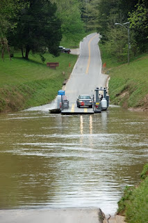
Once we returned to the trailhead, we all had long drinks of water. Also checked ourselves over for ticks; yes, the little buggers seem to be everywhere! I had a package to mail out to my niece Sammie for her birthday, so we stopped at the campstore where there was a post office. By now the sun was out, and we decided to do one more loop drive in the park before heading back to camp. We decided to do the Green Ferry Road drive, taking us past the Maple Springs Group Campground, down the Ugly Creek unpaved scenic byway, and also across the ferry...take a look!
That's the ferry! One vehicle at a time, although I suppose two smart cars would fit, and it's guided across the river by wires on either side. It was pretty neat!

It was time to leave the park, but there were many more cave tours available, dozens of hiking trails, and more scenic drives available. I was happy to have the one day available to at least get an overview of the park.

Tuesday night was not so good, though. We were watching the local news to keep an eye on the storms, and the weather radio started going off non-stop around 9pm. Severe thunderstorm watches, then warnings. Tornado watches, then warnings. I was not happy about that! I had my emergency plans in place, and knew where to go for shelter if necessary (the concrete bath house!). The local news finally went to continuous coverage around 10PM. The storm from was expected to go through here between 1am-2am. The winds really picked up, and I do have to say, I'm pleased with how the trailer held up during these ferocious winds, not too much moving around at all. I was watching the tornado cone very closely, as it was passing south of us around 10 miles. The thunderstorms arrived right on cue, and Chelsea took herself off to the shower, where she spent the rest of the night. We were up until almost 3am, when they gave our area the all safe signal and the weather radio stopped going off. There were still a few pretty good, deep rumbles of thunder rolling by here and there, but when I got up around 7am the wind had died down, and the rain was done. It's a lot colder though! It was actually quite interesting watching the meteorologists explain about the fronts crashing into each other, showing the demarcations on the maps, and how the tornados form. The only thing that would have been better is if we weren't SITTING in the zone at the time!

So we came through the storm ok, I feel better about riding things out here in the trailer, I know the weather radio works! and there's no wind damage here in the campground. To end on a really neat note, here's a picture of a very interesting animal we ran across here in the campground, and I'm so glad we got pictures because I know certain people would be saying, oh here she goes again, seeing things nobody else does!


It's an albino squirrel! Isn't that neat?

Tomorrow we move from here to Ohio for a week before our final move, for the summer, to Michigan. The weather tomorrow is supposed to be cool and dry, mostly sunny, so travel should be good. I hope the weather is a little better in Ohio next week, but it seems as if the spring hasn't been very nice anywhere along the east this year. It's a longer drive, so I probably won't post again until Friday or Saturday. Until then, have a great couple of days! Oh, and thanks to everyone who comments, I love it! Except to Anonymous who posts about fishing...please sign so we know which wise guy it is :-)!!