Welcome to our Adventure!

Al and I are thrilled that you have found your way to our blog. We hope you enjoy reading our journal and viewing our photographs of the natural wonder of our United States of America. Let's hit the road together!
Homer, Alaska

Friday, August 31, 2012

Lost Canyon

One of our co-workers, Sandi, had told us about a really nice drive about a half hour north of here called Lost Canyon. After we got off work one afternoon, we decided to take a drive up there, and do a little geo-caching along the zway. The directions told us to go north on Hwy 285, and just before getting to the town of Granite, turn off onto County Road 398...you gotta love these county roads in Colorado... no where else would these be considered roads :-). Anyway, our first stop was the Granite Cemetery.

Yep, there is a whole series of geocaches called "spirit quests", and take a wild guess where they are located!

Cemetery's have some great views around here :-)

We then took a hike down the mountainside from the back of the cemetery for two more caches...

Chelsea helped by checking out the creek...what remained of it anyway!

She also helped find one in "woody's basement"

The view as we started climbing up the road. We found two more along the Colorado Trail, but we were stymied by the last two along the way. One was in a dispersed camping campsite, and there were folks camping in it...we didn't really want to traipse through someone's campsite looking for a cache! The last one was at the summit of the road, and our truck was simply too big to make it up the final leg. We definitely don't want to get stuck someplace way up there in the boonies, that's for sure!

Beautiful view of Clear Creek Reservoir on the way down.

It's down to our last two weeks here in Colorado...sniff sniff. We are full to the brim for the weekend, and will be very busy. We also have had a bit of excitement, as the larger animals are starting to come back down from the lofty peaks, foraging and getting their winter fat on...we have had a visit in the lower campground from a bear. Just getting into the dumpster, but we still have to keep vigilant about making sure he doesn't become a danger to campers. One of our seasonal campers went jeeping and they saw some beautiful moose just up over the pass from us. And we even saw some juvenile bighorn sheep finally....running away from us, but still....
and so, as the trend in blogging is going, for today, this is...

The End!

Sunday, August 26, 2012

Sand, Sand, and More Sand!

Now that it is starting to get a bit cooler, it was time to make a day trip to another National Park within our driving area...Great Sand Dunes National Park and Preserve. About an hour and a half south of us, it was an easy day trip.

The Great Sand Dunes are in the San Luis valley, at the base of the Sangre de Cristo Mountains. The Dunes are the magnificent centerpiece of a natural system that includes high mountain peaks, sparkling streams (seasonal...not while we were there!), powerful winds and billions of grains of sand. The huge dunes, the highest being approximately 750 feet high, comprise about 11 percent of the enormous sand deposit that covers more than 330 square miles. Most of the sand originated in the San Juan Mountains, 65 miles to the west. Wind and water were the primary movers of the sand, the southwesterly winds beginning the slow process of bouncing the grains towards the low curve of the Sangre de Cristo mountains, where they piled up at the base of the mountains.

First view of the dunes as we drive in on Six Mile Road...actually 16 miles, but who's counting?

For a dry barren area the wildflowers along the roadside were beautiful

I saw this little guy peeking at me from the flowers

After stopping at the Visitor's Center and talking with a ranger, we headed out for High Dunes...those little specks just above the treeline are folks hiking the dunes

We parked in the High Dunes lot, and headed off to do a bit of dune hiking ourselves

This is where Medano Creek flows when there is water. 

The optimum time for photographing the dunes is either sunrise or sunset, not the middle of the day...

the photos still came out ok, I think! This is looking up from where we called it quits, about a third of the way up. Distances were very deceiving, and the sand was starting to bother the pups' paws

you feel very small and insignificant

more ripples

We drove a ways up the primitive road towards the Medano Pass, but could only go to "The Point of No Return" in our big truck...the sand got too soft from that point on. Turning back, we left the park and headed towards Zapata Falls Recreation Area, a few miles south of the park. We drove past a campground in the park that looked like it had awesome views of the dunes, if you could deal with having no hookups..we'll have to remember that for when we're going through the area in the future. We stopped for some food at the only place within 30 miles, The Oasis outside the park entrance. It was pretty good, and we were able to sit outside with the dogs at a picnic table. Some folks sat down right next to us, and after they left I remarked that it was pretty sad that our dogs are more well-behaved in public than some children are :-).

Zapata Falls was an interesting experience. To get to the parking area for the trailhead, you drive over 6 miles of some of the worst washboard road we've been on to date...and that's saying a lot! The trailhead information states that it's 1/4 mile to the falls...more like 1/2 mile, over a rock trail that has a very steep grade. Boy, these better be worth it!

Oh, but wait, it gets better! The trail ends at the creek...in order to see the falls, you have to get IN the creek, and wade upstream to the crevasse that the falls are coming through!

Ok, so here we go...luckily I had read about this, and came prepared with my Crocs...but boy, that water is COLD!

 
We made it to the crevasse...the water is cold, rushing over your feet at a really good pace, and I'm hanging onto the rockwall sides. I should have taken the polarizing filter off the lens, but didn't think about it being dark in there. So the picture isn't as sharp as I would like, but it was really awesome.

Heading back out the entrance to the crevasse...you really don't notice the water, its so clear, but be assured, there is COLD water covering the rocks!

Back into the sunshine..

and back down the trail!

A last view of the Dunes far in the distance

A little geocaching on the way home, and so ends another wonderful day out here in Colorado :-).

Saturday, August 25, 2012

Aliens Among Us....?


You do see the most interesting things when you are geo-caching......
just sayin'!

Wednesday, August 22, 2012

The Triple Crown

No, we haven't traveled to Kentucky, yet....however, we did attend the final leg of the Triple Crown Burro Races, here in Buena Vista. Yes, you read that correctly...burro races :-). Pack burro racing was started by some of Colorado's 19th century miners. The miners used burros to carry their equipment through the Rocky Mountains as they searched for elusive gold, silver and other valuable ores. Since the burros were fully loaded with tools and supplies, the miners had to walk beside them, leading them by a rope. There are two separate legends telling how the rise of racing began. The first one is that two miners found a vein of gold in the same location, and raced each other back to town to be the first to stake a claim to the find. Neither could ride their burro as it was fully loaded, so one of the first rules came about (you can't ride your burro in the race.). The second legend is that burro races started in Leadville, as some drunk miners in a local bar devised an easier method of making money than the back-breaking work of mining the ore.

The burro racing season goes from May to September, and comprises five races in five different mountain towns. The "Triple Crown" races are in Fairplay, Leadville, and finishes in Buena Vista. In May of this year, the Colorado legislature designated pack burro racing as a summer heritage sport in Colorado. Here in Buena Vista the weekend is known as "Gold Rush Days", and there are activities all weekend, and there's vendors, games and food booths in the park all weekend. We decided to go up on Sunday to see the start of the burro races, and check out the fair.

If you had told me a few years ago that I'd be crossing the street with a burro, I would not have believed you!

Packed up and waiting

And they're off...some were running full out right from the start...

some had a slower start :-)

All sizes, big and small. It's a fairly rigorous task, as they are running and leading the burros up and over several passes, for a total of eleven miles...and the winner does it in about an hour and a half!

We checked out gold panning at a demonstration...Karina and Jenna came with us for the day

A prospector came over and showed us how to do the panning...it was very interesting, and the girls came up with a few flakes of gold, along with some copper, quartz, aquamarine and carnelian. 

This puppy was tending his owner's booth!

This was pretty cool...a horse and cactus made out of horse shoes!

Now, there were a few things we needed to take care of....Karina and Jenna haven't been to too many carnivals, and had never experienced a few things....one was gold panning, which we took care of already. We started looking for lunch, and selected the booth that had brisket sliders...good, but very spicy BBQ sauce! They also had "mini funnelcakes"...I asked the girls if they wanted some, and they'd  never had funnel cake before. Ok, we have to correct that! I ordered, and then looked in the bag...never had it come in a bag before...and I said to the guy.."these are zeppolis!" he promptly asked me where I was from, and when I said originally New York, he nods his head :-). He said if he labels them zeppolis, no-one out here knows what they are! So he calls them mini funnel cakes. Too funny. Oh, and the girls approved of them!

Next up on the never-done-before list was bungy jumping.....for the girls!
Jenna goes first, and gets hooked up...

starts bouncing...

way up there....!

the flip....

and back!

Karina is next...doesn't get too much power behind her, so she gets a boost...

that gets her up there! No somersaults from her, though.

The last thing on our list before heading home was some dippin' dots ice cream...we do all enjoy our ice cream :-). Then it was back to the campground for a birthday pot-luck for one of our seasonal folks. We do enjoy our potlucks up here :-). 

We're getting closer to the end of our time here, and still so much to do! Next up for your enjoyment will be our day at Great Sand Dunes National Park, and Zapata Falls. Until then, have a great day!

Thursday, August 16, 2012

Geocaching Fun, and a Face Plant

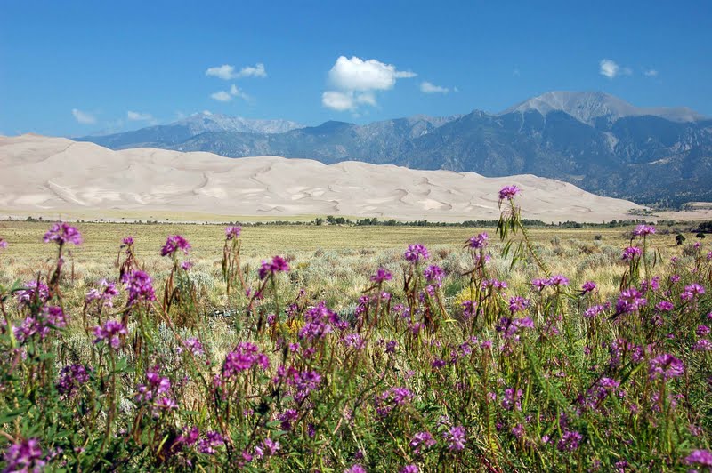
The past couple of weeks we've been staying close to camp, since our journey over to the Black Canyon and Ouray. We've recenently started geocaching, mainly due to the enthusiastic discussions with our fellow workamper Sandi. Most of you who RV know about geocaching already, but for those who don't, you can learn all about it here. As Sandi's husband Joe explains it, you use a handheld GPS worth a few hundred dollars, using technology worth billions of dollars (satellites) to "find stuff" :-). It's a modern day treasure hunt. The neat thing about it is that you go places looking for these caches that you may never have discovered otherwise.

So on one of our days off the past week, we picked one that was close by, and decided to go find it. It sounded nice, at the top of a waterfall, and would be a nice walk to take the pups on as well. We had planned on leaving early, but were also making breakfast that morning for the other workampers...omelets in a bag. We were going to make them for our "breakfast for dinner" potluck, but had some technical issues at the time. Being that we had three dozen eggs, we offered to make breakfast Sunday morning instead :-). So we got off to a little later start than we had hoped...after all, it is August in the mountains, and the afternoon rains almost always come through on the mountain. Anyway, we loaded up the water bottles, got our co-ordinates for the cache, and set off on Brown's Creek Trail to the waterfall.


The first mile was ALL uphill...lots of huffing and puffing, but great views of the valley behind us

We walked through trees...

and meadows....

and over logs crossing streams...the dogs had a definite advantage here!

and finally made it to Brown's Creek Waterfalls. It was really pretty, but I had read our directions wrong, and instead of being a 3 mile round trip hike, it was 3 miles one way. 

The cache co-ordinates were indicating that the cache was to our right, up the huge pile of boulders....I was not confident enough to climb up the pile, and with a 3 mile hike facing me for the return trip, did not want to walk further to find a route around. But we did see some nice waterfalls!

It was a very rocky hike back down the mountain, and we needed to go slow and careful to not twist an ankle!

A dip in Brown's Creeks at the end was refreshing for the pups!

The next day we wanted to go out again, but after six miles my body rebelled about doing another hike! So we picked a scenic drive, from the town of Como over the Boreas Pass to Breckenridge. It was a beautiful day, one of the monthly residents, Mike and Gigi, had recommended it, so we packed up the pups, maps, some geocache co-ordinates, and off we went again.
My research had told me to stop at Mountain Man Gallery for a roadmap guide to the pass, with numbered markers to guide us through the history of the pass. Unfortunately, the owner, also the postmaster, after she finished loading mail into the old-fashioned metal boxes in the back of the gallery, told me the markers were all taken down, so the guide was useless and she didn't print it anymore. Well, alrighty then!

Como has several interesting buildings, this train roundhouse is one. The historical societies raise money to slowly restore these buildings.

Up the road we went, looking for our first geocache...Roberts Cabin


Found it!

On the road again for the next one...

Al spotted this one!

Our last cache required more searching...

Beautiful view!

Even Chelsea joined in the climb

and another find :-).

That was our last cache for the day. We headed onward up to the summit....
Another Continental Divide Pass sign for my collection :-).


Several buildings were restored by historical societies, and I couldn't resist taking a picture of this sign :-).


We continued down the pass and into the ski town Breckenridge..looking for some lunch before heading back to Chalk Creek. We found a puppy-friendly spot at The Whale's Tale, also known as the gathering spot for the "After the Catch: season six" episode of "Deadliest Catch" series. Lunch was tasty, and we strolled around town for awhile...

A cute store with beautiful gardens

Casey was quite concerned about this!

Cupcakes, anyone??

So, we had a very nice couple of days off, and got started on a new hobby, geocaching. But lest anyone thinks that only good things happen around here, :-), I do have to admit that I had a bit of a fall yesterday :-(. It was totally my fault, and was on the flattest, easiest trail around that we walk on. We had gone out after working the morning shift, and took the dogs with us. After finding a few caches, we decided to take them for a quick walk on River Walk, in town, before going to dinner. I saw some cool ducks on the river, and I was paying attention to my phone, trying to ID the ducks, rather than what was going on around me. Well, Chelsea, whose leash I was holding, decided she had to go see another dog coming our way, and took off. I was completely caught off guard, and ended up getting dragged down, doing a face plant into the gravel path. Long story short, I am now sporting a very fashionable 10 stitches on my chin. And no, there are no pictures :-). Just goes to show you, it only takes seconds of inattention to lead to an accident. Otherwise, we're all fine, and its a minor bump in the road. Onto the next adventure!