Welcome to our Adventure!

Al and I are thrilled that you have found your way to our blog. We hope you enjoy reading our journal and viewing our photographs of the natural wonder of our United States of America. Let's hit the road together!
Homer, Alaska

Friday, August 29, 2014

Awesome Kayaking: String and Leigh Lakes

August 8 we went on a totally awesome kayaking expedition with John and Carol Herr, our summer companions this year. We've had some really good times with them this summer, and looking forward to even more. It's so wonderful how we meet like-minded souls out here on the road.

Anyway, they had already done this kayak trip earlier in the season, but enjoyed it so much that they went again, joining us on our day off. String and Leigh lakes are two of the beautiful and accessible lakes strung along the base of the Teton Range. Most were made by large glaciers that pushed out of the mountain canyons and left deep impressions that were further dammed by moraines. Other lakes were formed in basins scooped out by massive glaciers that moved through the valleys.

We arrived at String Lake early Sunday morning. It's a popular destination and the parking area fills up quickly, not only with kayakers but folks hiking around the lake and families enjoying the picnic and swimming areas.

After getting properly outfitted we pushed off from the shore. John and Carol have hard-sided kayaks, while we were in our SeaEagle tandem inflatable kayak. In Florida we have pretty much the same kayaks that John and Carol have, but just travel with the SeaEagle.

String Lake is a clear, shallow lake that looks more like a wide channel between Leigh Lake and Jenny Lake. It sits right against the steep lower slopes of Mount St. John and Rockchuck Peak, where periodic avalanches have kept the slopes clear of trees.

We were very happy to have gotten an early start, as String Lake becomes very crowded with swimmers and picnickers. 

The soft morning light and clear air made for nice pictures as well.

String Lake comes to an end, and then there's a short portage across dry land to arrive at the put-in for Leigh Lake.

The portage involved carrying the kayaks down this set of steps...which meant also carrying them UP the stairs on the return trip...well, we'll think about that when we get there.

Kayaks down the stairs and ready to go again. One of the prettiest lakes in the park, Leigh Lake has a sandy eastern shore and fantastic views across to Mount Moran. Mount Moran is one of the most highly visible and prominent landscape feature here in the Teton Range, and Carol really wanted to actually touch the mountain itself....so our goal was to get to the base of Mount Moran. 

Off we went, paddling into this beautiful scenery.

Sometimes one just has to kick back and relax....and I love my Keen water shoes, they are extremely comfortable....except I forgot to put sunscreen on my feet and ended up with little red patches of sunburn on my feet :-).

John admiring the majesty of Mount Moran.

One more peninsula to go around...

and we start heading into the bay where we can beach the kayaks and head ashore for some lunch.

It's absolutely breath-taking.

A close-up view of Mount Moran's summit....the black chunk of rock is called a diabase dike; we saw the same thing on the shore of the Schoodic Peninsula in Acadia last summer. It's a block of magma that shot up through a crack in the mountain during volcanic activity. The difference between this dike and the ones in Acadia are height of course (Acadia's are at sea level this one is over 12,000 feet in elevation), and size (Most of Maine's were not very large, being several feet wide; this one on Mount Moran is 150 feet wide). You can also see at the tippy-top of the mountain a light-colored "cap"; this is a sandstone patch, the remnants of a vast sheet of sandstone that once covered the continent. Geologists generally regard this sandstone as the basal layer of "marine transgression" that flooded most of the continent under seawater at one time. Subsequent to this "flood" the mountain block called the Tetons was lifted and then sculpted by glaciers.

Just a few steps from the landing area, we spotted a great fallen lodgepole pine trunk, seemingly just right for a picnic lunch. We had a peaceful lunch here by the creek, not another soul in sight. Carol was also very happy, having accomplished her goal of touching Mount Moran!

Lots of wildflowers, I believe this is the Lewis' Monkeyflower.

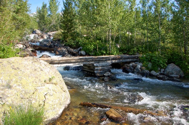
We heard that there was a cascade-type waterfall about a quarter of a mile inland from our picnic spot, so of course we headed out to find it. It involved navigating lots of rocks...

crossing the creek a couple of times....

practicing our balanced walking..

and finally found them! One creek crossing had us wading up to our knees, but I have no pictures of that, too busy keeping myself and the camera in an upright position :-). Yes, the water is COLD!

The upper level of the cascades, flowing through those two rocks at the top. It was really cool, but too risky to climb up any further. I didn't realize I needed to bring our hiking poles on a kayaking trip!
So, what is the difference between waterfalls and cascades? It was explained to us this way: waterfalls are like falling down a very steep set of stairs without touching any of the steps. Cascades are like falling down a set of stairs and bouncing off of each step on the way down. I say "ouch" either way.

Back to the landing zone we go....down past the last bush on the left is our thigh-high creek crossing is! There's also a "rest bush" in the area....who knew I would need to ever carry bear spray with me to attend to pit stops??

Back in the kayaks to head home. We had seen other waterfalls to the left of this picture and thought we could check them out as well, but it involved some serious bush-wacking that we are not ready for.

We paddled around several peninsulas, hugging the shore, watching for wildlife.

All we found was this pretty little mule deer as we portaged our kayaks back to String Lake.


Carol and John on String Lake; still beautiful but the sunlight is much harsher in the afternoon. String Lake is also VERY crowded with swimmers and boaters, especially close to the picnic area. 

After packing up all our gear, we headed back to the campground that Carol and John are staying at this season, the Gros Vente Campground near Moose, WY. We had a delicious grilled dinner of shishkebabs and fresh corn on the cob. It was a great day, and two weeks later we had plans to kayak on Yellowstone Lake, the largest natural lake at high elevation in North America. In between these two weeks we also made another trek to Yellowstone by ourselves, and spent our day off exploring Norris Geyser Basin and other neat stuff. But that will wait for another blog :-).

Tuesday, August 19, 2014

Hike to Bradley and Taggart Lakes

One sunny Sunday morning, since we had a very nice weather forecast, we had decided to get up early and take a morning hike on one of the more popular trails here in Grand Teton National Park, the trails to Bradley and Taggart lakes. Being in the peak of tourist season, it is necessary to arrive at trail heads early in order to secure a parking space, and also have at least a little peace and quiet on your hike. I also like to hike when its cooler out, and remember my lessons learned in Colorado two years ago: be off the mountains by 1PM, when thunderstorms start to rumble.

One of the things I find so fascinating about the Tetons is how they appear to magically rise straight up from the valley floor. There are no foothills in front of the major peaks. Periodically throughout the last 10-13 million years, earthquake-producing movement has occurred at the base of the range along a fault called the Teton fault. The mountain block continues to move skyward while the valley block hinges downward. Because the mountains are formed in this fault block fashion, the Teton range lacks the foothills typical of folded mountain ranges such as the Rockies. This geologic feature is one reason the Teton Range is unique. Anotherunique feature is that the individual peaks stand clearly apart from each other, and are in full view and clearly identifiable from almost any angle. It has been an unending source of fascination to me to see how many different views I can find of each of the peaks, depending where I am in the park.

The Tetons' array of glacial lakes also sets them apart. A dozen lakes lie right at the foot of the mountains, on the valley floor, with twice as many sprinkled throughout the canyons of the mountains. In general, the lakes at the base of the Tetons are the largest. Formed by glaciers that advanced out of the canyons about 15,000 years ago, they occupy deep depressions in the valley floor. Soil and rocks carried out of the mountains by ice were deposited at their terminal ends, building up berms called moraines. When the glaciers eventually melted back into the mountains, they left lakes rimmed with higher ground, called piedmont lakes. Bradley and Taggart lakes are examples of these piedmont lakes, and were our hiking destination that morning.

The route we followed was about 6 miles, starting and ending at the "you are here" marker. We took the right fork going up to Bradley Lake, then the squiggle down to Taggart Lake, then followed the south, circling back to the start through Beaver Meadows.

The trail starts off wide and level through the sage-brush dotted meadow. 

Turning right at the junction we started getting into a more wooded environment, and crossed Taggart Creek.

We now started climbing "gradually" up and over the moraine that I talked about earlier.

We had great views of the Teton Range, especially Grand Teton. It did keep going up, though!

This section of the trail went through areas that had burned in a fire in 1985. You can see how the forest uses the fires to regenerate growth.

We huffed our way up to the first view of Taggart Lake, high on the moraine. 


Catching our breath we continued the trek to Bradley Lake.


From this viewpoint you can't see Bradley Lake too well. It's smaller than Taggart, and more enclosed by trees. I think "maybe" if we continued around the lake towards Garnet Canyon we may have gotten clearer views, but our junction circling back to Taggart arrived and we were on a bit of a timetable....less folks hike to Bradley Lake so it was pretty quiet at this point; just the way we like it :-).

More uphill climbing, and 1.3 miles later we arrive at our second destination, Taggart Lake.

The trail finally heads down, and we are soon standing on the shoreline. The water is amazingly clear...and cold!

A clear calm morning allowed for some really nice reflection pictures. Beautiful views back into Avalanche Canyon as well. 

Foot traffic was really picking up at this point, and we found a nice clear area on the shoreline to have a long drink and snack. Have I told anyone how much we love it here?

At this point hikers have a choice: you can head back the way you came in, if all you did was the Taggart Lake trail, or for us it would be a cutoff trail back to the main trail, or you continue around the end of Taggart Lake to the footbridge and take the Valley Trail to Beaver Creek Trail back to the parking area. We decided to take this route, figuring less folks that way!

The trail switch-backed  up, initially making us regret our decision ;-), but then leveled out into beautiful views and huckleberry meadows.

Now bears are supposed to love huckleberries, so we were keeping a careful eye all around us, and yes, we were sporting our bear spray; alas, once again, I was bear "skunked"; not a sign anywhere.

We were rewarded with more spectacular mountain views however.

From here the hike was pretty much an easy downhill run all the way to the parking area, which, by the way; was filled to over-flowing when we returned around 12PM. We considered an auction for our parking space ;-) but decided against that idea.


Some of the wildflowers we saw along the trail, and red huckleberries.

It was another great hike just about 6 miles in length. Bear in mind that I am behind in my postings, as usual, and we did this hike towards the end of July. For something a bit different, but just as much fun, our next adventure took us on a 7 1/2 mile kayak on String and Leigh lakes with our good friends Carol and John Herr. Hopefully, I'll have that post up shortly...I'm trying to catch up, I really am!