Welcome to our Adventure!

Al and I are thrilled that you have found your way to our blog. We hope you enjoy reading our journal and viewing our photographs of the natural wonder of our United States of America. Let's hit the road together!
Homer, Alaska

Monday, May 5, 2014

More River Walk and San Antonio Missions NHP

Last Wednesday was our last day down in the River Walk. Our morning was spent the same as the previous two days, walking a stretch of the river. We did the last main section of the River Walk...
from the top of the "T" section down towards the right hand leg of the walk, to the King William Cultural Arts District. 

We walked down this man-made section and turned left...

to the Nuevo Street Dam and Marina. This is as far as the river barges can go, and are parked overnight behind the bridge to the right.

As with the Museum Reach Extension, there are far fewer people out and about as you get further away from the shopping/dining section, making it wonderful for a good exercise walk with the dogs. 
After the Mission San Antonio de Valero (The Alamo) was secularized in 1793, the surrounding land and fields were distributed to the Native Americans and other local peoples to cultivate. Newly arriving settlers from both the United States and Europe purchased much of this land for their homes and farms. By the late 1800's the area became known as "Sauerkraut Bend" because of the dense German population and the curve of the river. The area thrived for about 50 years, then started to fall into disrepair. Preservation efforts begun in the 1940's gathered momentum by the 1970's, and today the King William area contains the city's most lavish and elegant homes.

We strolled down King William Street, known as the most beautiful residential street in all of Texas.

Some of the smaller homes date from the 1860's.


It certainly has some beautiful homes. There is also ample evidence of several of the older homes undergoing extensive restoration. I can only imagine the constraints they are under, and how expensive that must be.

One gate was still colorfully decorated for Fiesta!

Our morning was was done and once again we returned to the RV Park for lunch and to let the dogs have their afternoon siesta. Our goal for the afternoon was to visit the four remaining missions of San Antonio that comprise San Antonio Missions National Historic Park. We headed out, our destination being the Visitor Center to collect information and, of course, a stamp in our Passport book.

The Visitor Center is at the largest mission, Mission San Jose y San Miguel de Aguayo. We aren't usually lucky, as everyone knows :-), but we got there just in time to join a ranger-escorted tour of the Mission. I'm very happy we did, as we learned so much more than if we had just wandered the grounds.

Right outside is this beautiful mesquite tree. In times of drought the branches curve down and enter the ground searching for water sources. In good times they will re-emerge again. I found that pretty cool.

The grounds of Mission San Jose comprised 600 acres of land. Now, the Franciscan friars' only objective in building missions, under the directive of the Spanish government, was to convert indigenous hunters and gatherers into Catholic, tax-paying subjects of the King of Spain. Conditions for the Native Americans were so awful (drought, disease and attacks from the Apache) that it was fairly easy to convince them to enter the missions, where they were housed, fed and trained in various trades. 
Mission San Jose was founded 2/23/1720. Three different Indian tribes were "recruited, and construction began on the compound's outer perimeter, the convento and the granary.

This picture gives you an idea of the size of the compound. I'm standing in the right back corner of the walled area looking out towards the other end.

The housing units for each family are all along the three walls of the compound ( with the fourth side being the cathedral and convento). Each extended family (grandparents, parents, children and unmarried older children, possibly between 12-15 people) were housed in a total of two rooms.

One room with a hearth...which is actually not historically accurate as the ranger told us they did all their cooking outside. 

Besides being housed, fed and trained in new trades, the Indians were given extensive religious instruction to prepare them to be accepted and baptized into the Catholic faith. The cathedral construction was begun in 1768, the peak of this mission's development. At that time there were up to 350 Indians residing in 84 apartments. The church is built of limestone with extraordinary Spanish colonial Baroque architecture and statuary.

The convento with it's arched entries come off of the back of the church. Many San Antonio weddings are photographed here.

The Rose Window is a highlight of the church. The Indians were denied entry to the Sanctuary until they were baptized, so they gathered here at this window to receive their religious instruction each day by one of the friars. Folklore credits Pedro Huizar, a carpenter and surveyor from Spain, with carving the famous window as a monument to his sweetheart, Rosa. Tragically, on her way from Spain to join him, Rosa was lost at sea. Pedro then completed the window as a declaration of enduring love.

Our tour ended here at the front of the church. It is still an active church community to this day, and we did have permission to enter to view the beautiful interior.

An interesting side note here: being an active church community, it was asked what happened during last October's government shutdown. The "grounds" of the mission belong to the National Park system, but the church belongs to its community. So the church was "open", just the sidewalks going to it "closed". however, there is an entrance through the convento that the community used to access the church for services.

Much of Mission San Jose has undergone reconstruction, as the limestone had started crumbling and much of the support structure had become compromised. The next mission on the tour, however, is much revered because it has withstood the test of time and is still completely intact.

Mission Nuestra Senora de la Purisima Concepcion de Acuna

Enduring time and elements for 250 years, Mission Concepcion stands as one of the country's oldest original stone churches.


Original frescoes have endured as well.

Mission Concepcion

A much smaller mission, Mission San Juan Capistrano was our third stop.

The construction of the mission and church was completed by 1731. These partial walls are the remains of a plan to build a new and larger church in 1772. Dwindling numbers of Indian labor led to the abandonment of the project in 1786. 

All travelers arriving to a mission had to be approved and granted passage into the mission through the lone entry gate, the porteria. 

Mission San Juan is small, but still a vibrant community. We had to delay our picture taking here as a bride was posing for portraits while we were there!
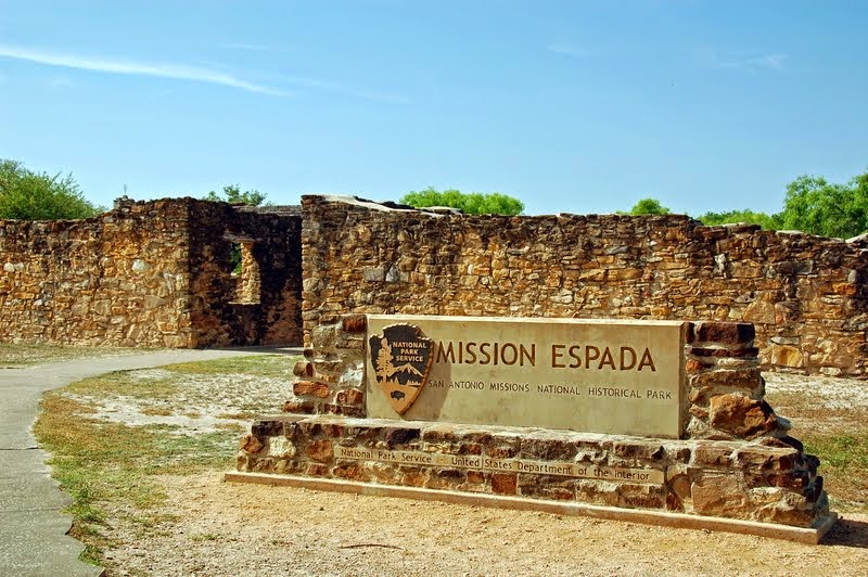
It was almost closing time so we made a mad dash for the last mission, Mission Espada. Another very small mission, it is currently closed for extensive renovation. I did manage a picture through the chain link fence.


This brings to a close our three days of exploring San Antonio's River Walk and historical sites. We have one day left here that we spent up in Fredericksburg at The National Museum of the Pacific War. I'll talk a little bit about that and then our journey north to Santa Fe in the next installment. I hope you have enjoyed my tour :-)!

Sunday, May 4, 2014

Good Intentions and All That

I really really meant to keep up with this; I don't know HOW other bloggers do it! By the time I spend the day DOING, I'm tired and ready to go to bed so I can get up and DO again :-)!

We are now in Santa Fe, having spent 5 full days in San Antonio, then spent two days driving 700 miles to arrive here at Los Suenas de Santa Fe RV Park. It's not a real pretty campground, but it is a central location for the activities I have planned for the area. I had seriously considered the COE campground at Cochiti Lake as it looks like a gorgeous location, but for a quick touring expedition it would have involved a lot of driving. But, let's go backwards and see what we were doing down in San Antonio.

As I wrote in my last entry, we were seeing some pretty high temperatures while here, so we were adjusting our plans accordingly. Up in the morning for a long walk exploring sections of the River Walk, back to the campground for lunch, settle the pups in for an afternoon siesta while we went places they couldn't go (yes, there are places pups aren't allowed, as unfair as it sounds). This actually worked out pretty good, as we soon discovered that San Antonio is NOT an early rising town, leaving the River Walk pretty deserted for our morning rambles.

The San Antonio River Walk is a public park, a network of walkways along the banks of the San Antonio River, one story below approximately 5 miles of downtown San Antonio. It winds and loops along the river as two parallel sidewalks lined with hotels, shops, restaurants and attractions. Monday we had started at the far left of this map, actually off the map in a new expanded section of the Walk called Museum Reach Extension and walked down to about the middle of the u-shaped section. Retracing our steps back to the car that day gave us almost 6 miles of walking.

Tuesday morning we parked at the Rivercenter Mall, near the very top of the map. We then walked down the T-shaped extension as our destination was La Villita (to the right of the top of the u-shaped section).

A favorite section of River Walk, the popular Casa Rio restaurant. We did have dinner here that night and it was very tasty!

La Villita Historic District is San Antonio's first neighborhood, offering shopping, dining and history. The district was once a military post where families of Spanish soldiers lived in simple adobe huts.

The neighborhood became desirable after the 1819 floods destroyed many prominent citizen's homes. European immigrants settled here in the mid-1800's.

Currently the restored structures are home to artisan's shops and a few small eateries.

La Villeta is home to the Arneson River Theatre, an open air theatre where the river runs between the stage 

and the moss-covered bench seating.

After we finished poking around La Villeta, we got back down onto River Walk and headed for another destination this morning, 

San Fernando Cathedral. It is considered the "heart of San Antonio" both culturally and physically: There is a spot on the floor of the Cathedral marked as the exact center of the city.The original church was built between 1738 and 1749 and its walls form the cathedral's sanctuary. The original church tower was used to spot the arrival of Santa Ana' and the Mexican army in 1836. The tower was removed during the construction of the French Gothic addition in 1868.

The marble coffin said to hold the remains of some of the Alamo's defenders is located in a chapel in the southeast corner of the cathedral. The remains were found buried under the sanctuary railing of the original church in 1936.


It was quite beautiful inside.

After our view of the San Fernando Cathedral we headed back to River Walk, and today I got a picture of the "cleaning boat". See how they open the skimmer wings to clean the debris out of the river? I thought that was really neat.

This interesting building on the river is the original office of Robert H.H. Hugman, an architect who many consider to be the father of River Walk. In 1929 he presented a master plan to the city of San Antonio for the development of the downtown river bend. Hugman's plan proposed a balance between commercial and park-like qualities, while maintaining the river's natural character and preserving old world architecture.

Even the stairways leading back up to the city level are beautifully done.

After lunch, the dogs settled down for their afternoon siesta, and we headed out for our own afternoon history lesson.

The Alamo is one of six original missions that settled along the banks of the San Antonio river in the early 1700's. One mission failed, but the other five thrived for quite a long time. The Alamo began as the San Antonio de Valero, and played a crucial role in the settlement of San Antonio, Texas and the Southwest. The two original buildings were the Convento, or Long Barrack (1724) and the Church (1744). By 1756 however, the walls of the church started collapsing, and remained ruined until the both the Mexicans and Texians fortified it during the Texas Revolution. After the battle, it remained in ruins until the U.S. Army began repairs in 1850. So while the walls of the church are over 250 years old, the facade as we know it is only about 150 years old. The Alamo is now a State Park while the remaining four missions are part of San Antonio Missions National Historical Park.

The Convento, which has been restored and is now a beautiful museum with many exhibits pertaining to the battle. The complete history of the Battle of the Alamo is extremely interesting, and WAY too involved for me to get into here. It had been suggested by "guides" that we would spend about an hour here, but you know us, I think it was at least 2 1/2 hours before we saw and read everything. We also did the audio wand tour, which we find is an excellent way to self-guide yourself throughout an exhibit like this without missing anything. We had also been told by several people that we would be "disappointed" with the Alamo, but honestly, having never watched the old "Davy Crockett" shows, I had no pre-conceived notions of what it was like, and so found I could readily imagine what it looked like during that time. I found it quite interesting all in all.

We ended our afternoon by taking a barge cruise...everyone said we "had to", so who were we to argue?? It was very nice, and learned a few tidbits that we hadn't known as we were walking around the area.

Going back to the map, we learned that the u-shaped bump-out is the original flow of the river; the section going across it was man-made, to control the flow of water to the area preventing further flooding of the main commercial district. the T-shape off the end is also man-made, and was made for the 1968 World's Fair in the city. Hemisfair Park was the area designed to house the Fair, and the city developed this off-shoot of the river to help move the flow of people from River Walk to the World's Fair.

A section of the man-made canal leading to Hemisfair Park.

Along the way is a bronze statue of San Antonio's patron saint, Saint Anthony. The sculpture was presented to the city by the Portuguese government at the 1968 Hemisfair.

Finally, we ended the afternoon with an early dinner at Casa Rio, at a riverside table. It was a lovely end to a lovely day!

This is now long enough, so our Wednesday and Thursday adventures will have to wait.....