The Great Sand Dunes are in the San Luis valley, at the base of the Sangre de Cristo Mountains. The Dunes are the magnificent centerpiece of a natural system that includes high mountain peaks, sparkling streams (seasonal...not while we were there!), powerful winds and billions of grains of sand. The huge dunes, the highest being approximately 750 feet high, comprise about 11 percent of the enormous sand deposit that covers more than 330 square miles. Most of the sand originated in the San Juan Mountains, 65 miles to the west. Wind and water were the primary movers of the sand, the southwesterly winds beginning the slow process of bouncing the grains towards the low curve of the Sangre de Cristo mountains, where they piled up at the base of the mountains.

First view of the dunes as we drive in on Six Mile Road...actually 16 miles, but who's counting?
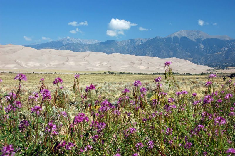
For a dry barren area the wildflowers along the roadside were beautiful

I saw this little guy peeking at me from the flowers

After stopping at the Visitor's Center and talking with a ranger, we headed out for High Dunes...those little specks just above the treeline are folks hiking the dunes

We parked in the High Dunes lot, and headed off to do a bit of dune hiking ourselves

This is where Medano Creek flows when there is water.

The optimum time for photographing the dunes is either sunrise or sunset, not the middle of the day...

the photos still came out ok, I think! This is looking up from where we called it quits, about a third of the way up. Distances were very deceiving, and the sand was starting to bother the pups' paws

you feel very small and insignificant

more ripples

We drove a ways up the primitive road towards the Medano Pass, but could only go to "The Point of No Return" in our big truck...the sand got too soft from that point on. Turning back, we left the park and headed towards Zapata Falls Recreation Area, a few miles south of the park. We drove past a campground in the park that looked like it had awesome views of the dunes, if you could deal with having no hookups..we'll have to remember that for when we're going through the area in the future. We stopped for some food at the only place within 30 miles, The Oasis outside the park entrance. It was pretty good, and we were able to sit outside with the dogs at a picnic table. Some folks sat down right next to us, and after they left I remarked that it was pretty sad that our dogs are more well-behaved in public than some children are :-).

Zapata Falls was an interesting experience. To get to the parking area for the trailhead, you drive over 6 miles of some of the worst washboard road we've been on to date...and that's saying a lot! The trailhead information states that it's 1/4 mile to the falls...more like 1/2 mile, over a rock trail that has a very steep grade. Boy, these better be worth it!

Oh, but wait, it gets better! The trail ends at the creek...in order to see the falls, you have to get IN the creek, and wade upstream to the crevasse that the falls are coming through!

Ok, so here we go...luckily I had read about this, and came prepared with my Crocs...but boy, that water is COLD!

We made it to the crevasse...the water is cold, rushing over your feet at a really good pace, and I'm hanging onto the rockwall sides. I should have taken the polarizing filter off the lens, but didn't think about it being dark in there. So the picture isn't as sharp as I would like, but it was really awesome.

Heading back out the entrance to the crevasse...you really don't notice the water, its so clear, but be assured, there is COLD water covering the rocks!

Back into the sunshine..

and back down the trail!

A last view of the Dunes far in the distance
A little geocaching on the way home, and so ends another wonderful day out here in Colorado :-).


