While here in Capitol Reef, there is a driving loop tour comprised of the Notom-Bullfrog Rd, the Burr Trail Road and then Highway 12 back to Torrey. We decided to try it out and had very good success :-).

Notom-Bullfrog Road was about a 20 minute drive east from our campground. It runs parallel to the Waterpocket Fold on the east side, and allows access to many trailheads and scenic features in Capitol Reef's southern district.

Casey was ready for the day's adventures!

The first 6 miles or so are paved then turn to dirt roads. Easy driving, just a tad dusty. The Waterpocket Fold's buckle is the uplifted slabs starting at the right side of the picture and heading around in front of the road. The road does curve and follows the buckle.

On the left side of the road were these dunes, and yes it was crusty sand; Al and the pups got out to investigate while I was taking pictures.


Close-up views of the buckled earth.

We arrived at the junction with Burr Trail after about 30 miles. You can continue the Notom-Bullfrog Road all the way south to Bullfrog Marina on Lake Powell or turn off onto Burr Trail as we did. However, we had to get from way down here to way UP there! Remember, the west side of the Fold is 7000 feet higher than the east side.


Climbing the switchbacks....really glad I'm not hiking this!

Looking back down to where we started from.

Up on top and we are in real red country now! We find a quiet dirt road and drive down, looking for a spot to have lunch...this was our view, not so bad eh?

Burr Trail is named after John Atlantic Burr. His family had settled in Salt Lake City, and he moved south where he established the town of Burrville UT in 1876. He developed a trail through this nearly impassable country to move his cattle back and forth between winter and summer ranges and to market.

Once back in Boulder on paved roads, you follow Scenic Hwy 12 up and over Boulder Mountain returning to Torrey. As we got down the mountain, we were feeling the need to stretch our legs and I read of a short trail to a waterfall at the back of Singletree Campground, a National Forest campground. So we swung in, found the camphost (very pleasant) and he directed us to the trailhead. It's a primitive campground, no hookups, but really pretty, quiet and had nice sized sites, even for larger rigs, so if anyone out there is looking for this type of place, I recommend it.

The camphost had told us if was a short 1/2 mile hike to the falls; information that was not given to us was that it was a 1/2 mile STRAIGHT DOWN, meaning the return was a 1/2 mile straight up! We managed, even at over 8000 feet, although it took me a little longer than I would have liked :-).

The reward; not truly spectacular, but at least there was a waterfall!
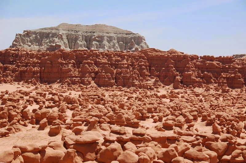
A different day we took a drive to the unique Goblin Valley State Park.
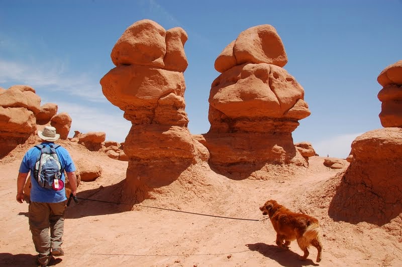
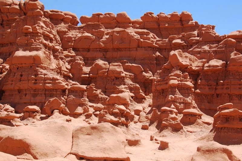
Goblin Valley is an area where the soft sandstone has eroded into truly individual shapes, said by some to resemble goblins.

Several areas have many goblins close together, creating a maze-like arena where you can wander around at will.
With it's somewhat surreal appearance, Goblin Valley was selected as a site to film scenes from the movie "Galaxy Quest".


The official term for these structures is "hoodoos"; a hoodoo is a tall, thin spire of rock protruding from the bottom of an arid drainage basin or badland. Hoodoos can range from 5 to 150 feet tall, and consist of relatively soft rock topped by harder, less easily eroded stone that protects the column from further erosion.
Goblin Valley State Park is the site of the infamous toppling of a hoodoo by three Boy Scout leaders last year.

Now, remember the term "hoodoos" for the next installment of our adventures here in Utah....a day trip to the beautiful Bryce Canyon National Park!
I have uploaded all my pictures of our adventures in Utah so far to my Flickr account. If you would like to see all pictures to this date, go to: https://www.flickr.com/photos/22321510@N02/sets and click on the Capitol Reef National Park album.
I love the hoodoo's. Thanks for posting. It looks like we're not getting that far west. We had a wonderful time today in the arches.
ReplyDeleteThanks for going to dinner with us last night. We hope to see you again soon.
Amazing Photos!! Never heard of Goblin Valley State Park...how cool:o)) Thanks for taking us along!!!
ReplyDeleteLots of hoodoos in the west, they can have some very interesting shapes :)
ReplyDeleteLove it-
ReplyDeleteLove Bryce Canyon and UT in general, can't wait to get back out there. I drive our other vehicle too, a Honda Ridgeline that can take us almost anywhere and keeps the miles off of our tow vehicle too.
ReplyDeleteAwesome! I can hardly wait to get out there and see it in person.
ReplyDelete