We checked out the menu at the takeout window, and before I made my decision on which sandwich to have, I asked the pleasant young lady at the window what the "Toll House Delight" is. A warm toll house cookie topped with a sundae...well all righty then, I'll have a grilled cheese sandwich, no fries or chips, and the Delight please!
Looks good doesn't it :-)!
Ok, so it was then time to work some of those toll house calories off! Campobello Island has a significant portion of land parcelled into two parks, the Roosevelt Campobello International Park and Herring Cove Provincial Park. Directly across from the Visitor Center is Glensevern Road, which is the dividing point between the two parks. The park roads are former carriage roads that are now narrow gravel roads, leading you to the points of interest throughout the park. We had several geocaching locations to check out, so off we went. We've found quite often that geocaching has led us to some beautiful locations, and today did not disappoint :-).
Our first spot was the boardwalk at Eagle Hill Bog. This is an interpretive nature walk, where you picked up a brochure at the trailhead and signposts marked special points of interest. It leads to a ridge that has a beautiful overlook...and a cache!
It's too early for many of the flowering plants on the tour, but we did see these pitcher plants, a carnivorous plant. The water collects in the "pitcher", luring insects down to drink. They are then trapped by the leaves folding down, like a venus flytrap. Cool!
Once across the bog, there's a forest trail up to the ridge.
Tree-top view
These are larch pines...they lose their needles in the winter. I couldn't believe how soft theses needles are.
The next stop was Raccoon Beach...to the left....
and to the right.
Liberty Point is on the south end of the island, and has three observation platforms looking in different directions.
This is Sugar Loaf Rock....can anyone see anything in this rock?? Kudos to the first one who guesses one of the two images said to be seen in it.
An iconic picture of Maine....love the birds flocking behind the lobster boat!
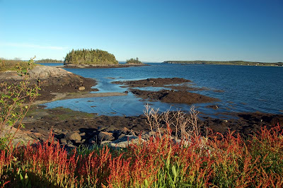
Cranberry Point
Last cache of the day at Upper Duck Pond
Gentle swells swirling onto the shores of Upper Duck Pond.
There are 7.7 miles of these old carriage roads, leading to over 8 miles of walking trails. It was such a calm, peaceful place, I can definitely see how it appealed to FDR and his family as a retreat away from the bustling urban centers. It was a very nice day, with a good history lesson, peaceful walks, and five caches found! It was worth the 2 hour drive each way for sure.


Looks like a big lizard to me, or a breaching whale. :)
ReplyDeleteJust lovely! Love the lighthouse picture too :)
ReplyDeleteJust beautiful! Can't wait to get up there.
ReplyDeleteI can't believe how beautiful it is! I'm drooling :)
ReplyDeleteI think it's a whale.
Beautiful! We really need to get up that way one day.
ReplyDeleteGreat pictures, but I like the ice cream best:)
ReplyDeleteIt looks like a monitor lizard to me too. What was the other image?
ReplyDeleteGreat pictures! The ice cream sundae looks wonderful!
ReplyDelete