On our way to our adventure in Ouray last week, we stopped at the Black Canyon of the Gunnison National Park both going to Ouray and coming back from Ouray. To do both rims of the Black Canyon is too much for one day, so wanting to experience both the North Rim and the South Rim, we split it up into the two days, incorporating the experience into our driving days. No sense wasting time, now, is there?
The Black Canyon is a deep, precipitous gorge hacked out of the ancient bedrock by the Gunnison River. The National Park protects 12 miles of the 50-mile-long canyon. The Black Canyon slices through an upift that reaches elevations above 8,000 feet. Time and the flowing river created the Canyon, which is between two and three million years old. The Gunnison River has one of the nation's steepest river gradients, dropping 2,150 feet from the canyon head at Sapinero (now under the Blue Mesa reservoir) to its North Fork junction, an average fall of 43 feet per mile. In the two miles from Pulpit Rock overview to Chasm View overlook, it descends and astounding 480 feet. That steep gradient, combined with the abrasion of tumbling boulders on the riverbed, gives the Gunnison a sharp cutting edge. Geologists estimate the river deepens the canyon by about one inch every century. But enough words, let's get onto some pictures!

We drove the North Rim on our first day...this is a picture of the pontoon boat at the dock from the Morrow Point Reservoir tour.
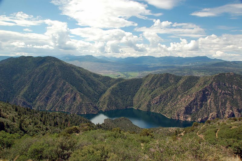
View of the South Rim and the San Juan Mountain range in the distance

We drove to the ranger station to check in and get my National Park stamp :-), with the intention of hiking to Exclamation Point, described in my photography guide as the best view of the canyon in the park. However, there was a very bad sign at the trailhead, at least for us..."no dogs". Ugh! I was discussing this with the ranger, who agreed with me that we are the only user group discriminated against in the National Park system. We were allowed to walk them on the shorter overlook trails along the rim, so that's what we did. We had a picnic lunch in the campground, and then walked down the Chasm View Trail to see this view of the Painted Wall and the streaked walls.

There was no parking directly at any overlook, there was always a short trail to walk to the overlook. The trails are very well-maintained and easy to follow.

The river cutting its path through the canyon

Looking down at rock formations

This photo was taken at Kneeling Camel Overlook....can you see the camel??

Onto the South Rim. This is taken at Gunnison Point. We had elected to drive the South Rim on our return trip from Ouray to the campground. Even though the rims are only about 1100 feet apart at points, it is a long drive, 2 1/2 to 3 hour drive each way. And no, there is no bridge from rim to rim...apparently people do ask :-).

Al and the kids at Pulpit Rock Overlook

View of the West Elk Mountains

A great view of the Painted Wall at Cedar Point overlook. Painted Wall is Colorado's highest cliff, with a 2,240-foot vertical rise from base to rim. The "painted" strips are pink pegmatite bands slashing across the cliff. (pegmatite is a coarse-grained igneous rock for the geologists in the crowd).

A final view of the canyon, and river.
We really enjoyed our days exploring the Black Canyon of the Gunnison. For more adventurous, and hardy, souls there's hiking down into the canyon, fishing, even rock climbing. We did have an enjoyable day just driving the rims, and walking each of the overlook trails.
Next up on the adventure trail: our first experience with off-road jeeping in lovely Ouray, otherwise known as the Switzerland of America!
Once again, a fabulous photo journal. Thanks for the tour.
ReplyDeleteNice trip,I see the camel.
ReplyDeleteSent you an email today about the opportunity at Chalk Creek but I received an error message so not sure if you received it. Could you contact me @ kdesert1947@gmail.com. Thanks Becki
ReplyDeleteNow that's some big rocks!! Sure is beautiful. Thanks for the tour!!
ReplyDeleteI saw a comment where you may be working in Acadia next year--how cool is that!!!!
ReplyDeleteThis is just gorgeous Karen. I've never been here but have always wanted to go and now I know exactly what I've been missing.
ReplyDeleteIt is a shame that a few folks who allow their dogs to bark and don't clean up after them have caused the national parks to limit where dogs can go. I heard there were a lot of complaints for a number of years about dogs "ruining people's wildlife experiences" before that rule was enacted.
Great photo journal. The area looks fabulous and the campground sounds like a great opportunity for another workamper couple. I am going to put it on my list of places "I'd like to work" at.
ReplyDelete