Welcome to our Adventure!

Al and I are thrilled that you have found your way to our blog. We hope you enjoy reading our journal and viewing our photographs of the natural wonder of our United States of America. Let's hit the road together!
Homer, Alaska

Saturday, July 28, 2018

Lake Mead Recreation Area and Valley of Fire, Nevada

Note: still in catch-up mode from the spring travels. This was the end of April 2018.

Leaving Flagstaff, it was an easy day of driving to Lake Mead Recreation Area. Straight west on I-40, then hang a right at Kingman, AZ., onto 93, straight into Lake Mead. I like the easy days of driving :-). We decided to splurge here since we were staying at the Boulder Beach RV Park and booked a lakefront site. The sites were beautiful: level, concrete, quite large, with a beautiful view out our window of Lake Mead. 
Image may contain: ocean, sky, cloud, outdoor, nature and water

Lake Mead is a man-made lake formed by damming the Colorado River with the famous Hoover Dam. The recreation area encompasses a total of 1.5 million acres of land, following the Colorado River from the westernmost boundary of the Grand Canyon National Park to just north of the cities of Laughlin, NV., and Bullhead City, AZ. In 1964, the area became the first National Recreation Area to be designated by Congress as such.  


Our primary mission and a reason for stopping here on the way to Death Valley National Park was to visit with some old RV friends, Steve and Joan Crowe. They've spent a few winters here as volunteers. Once we were set up and settled, they headed over in their awesome red jeep (fully outfitted for the supreme off-roading experience!) to pick us up and head off for dinner, because, you know, that's what RVers do when they get together; we go out to eat! :-). Boulder City, NV., is south of Las Vegas and is a really nice town. It came into existence in 1931 as an area to house the workers building Hoover Dam. Because of the scope and duration of the work, a more permanent town was planned and built rather than temporary housing. Boulder City was actually conceived and planned through federal supervision, and as the Hoover Dam itself was a project of optimism for the country, suffering through the effects of the Great Depression, the city was planned with an emphasis on making a clean, pleasant living environment for the workers. There was plenty of open public space and landscaping in the design which eventually earned Boulder City the title of "Nevada's Garden City." And as Joan and Steve were giving us the tour of the city, we could see how nice the public areas are, and the pride in the town was quite evident in the neat and tidy residential areas. Many of the old block houses are being renovated into really cute homes. We did like Boulder City and think it is a great place to hang out for a while. 

After dinner, we went on an off-road excursion to view the sunset behind Lake Mead. After Steve asked if anyone had a fear of heights (!), we headed into the backcountry behind the dam. The trail ran along a crest of a ridge, and yes, it was quite narrow and dropped off quite steeply on both sides of the trail. I was super glad Steve is an experienced jeeper, although I'm sure this trail was easy-peasy for him. 

Image may contain: sky, cloud, mountain, ocean, outdoor and nature
The next day was a work day for Steve and Joan, so we planned an excursion to the north end of the recreation area to a Nevada State Park called Valley of Fire. Unfortunately, we didn't do any hiking there. There are some beautiful trails that wind into the formations, but it was a tad hot here...
No automatic alt text available.
So, number one, we didn't want to leave the dogs alone in the trailer just in case something happened and the air conditioning went out, and, number two, look how hot it was! Not safe to do any kind of hiking in that heat. So we just had a nice driving tour through the park.

Valley of Fire consists of bright red Aztec sandstone outcrops nestled in beds of gray and tan limestone mountains. In 1912, a rough road was carved out through the landscape, allowing people to travel between Salt Lake City and Los Angeles. The name "Valley of Fire" was coined by an AAA official traveling through the area at sunset in the 1920s. 8500 acres of this land was given to the state of Nevada in the 1920s, and in 1933 the Civilian Conservation Corps built the first facilities and campgrounds. In 1934 the park was officially opened as the first state park of Nevada. Valley of Fire now has 40,000 acres of multicolored rock, displaying a varied array of shapes and textures. 


The next day, we decided to take a tour of the Hoover Dam. We had been over it once many years earlier, but never took an actual tour of the facility. We headed over there early in the morning and got tickets for one of the first tours of the day. We took the hour-long dam tour, which includes a movie about the building of the dam and a tour of the power plant. 


After our tour of the Hoover Dam, we headed back to the rig for some lunch, and then Joan and I took an excursion to Ethel M Chocolate Factory and Cactus Garden. We told ourselves that the primary reason was to view the gardens, hoping that the cacti would be in full bloom, but we both ended up walking out of there with a good sampling of handmade chocolates to last a few days! Some of the cacti were blooming, but it was just a tad early for most of them. The chocolates, however, were delicious!


Steve and Joan were at the end of their volunteer stint at Lake Mead, with their last day occurring while we were visiting. We spent our last night there visiting with them in their gorgeous new Entegra motorhome and said our fond farewells as we were heading over to a new national park for us, Death Valley National Park, and they were headed up to North Dakota for their summer volunteer jobs at Sully's Hill National Game Preserve. We had been looking forward to exploring the state of Nevada on this expedition west this spring, our first time here in the state since we started RVing, and so far it's off to a great start!


Thursday, July 26, 2018

Monument Valley


I'm back!!! It's only been a month or so.....:-)

Still writing about the spring trip here. But rest assured, we're hard at work and play here in Wyoming. We've had some great hiking and kayaking so far this summer, and I will do a photo essay on our adventures, but I do want to keep a record of the spring trip.

So we left off at Bernalillo, N.M., and our hike at Tent Rocks. We had left Bernalillo and headed towards Tsé Biiʼ Ndzisgaii, Navajo for Monument Valley, on the Arizona/Utah border. The area is a Navajo Nation Tribal Park, considered the private land of the Navajo Nation. You can choose to pay an entrance fee to enter on your own, but you are limited to driving the one road through the monuments. Upon the advice of friends of ours, Lee and Tracy Perkins of Camper Chronicles, we elected to sign up for a Navajo-guided photo tour of the valley that takes you off the beaten path. 

Just a side note here: the road from Bernalillo to Monument Valley is pretty remote, and much of it traverses Navajo land. Farmington is the last spot to really have any services, so make sure you are not low on fuel at this point! We also ran into a major wind/sandstorm that had not been forecasted, and I definitely advise not driving in one if it's not necessary. Unfortunately, by that time we were on the reservation and there were no opportunities to stop. We made it, but it was not my favorite day of driving!

Our first day there was spent recuperating from the drive, doing some laundry, and just generally scouting the area. It wasn't a nice day, still very cloudy, so I didn't get many pictures. We did drive up to Goosenecks State Park and wander around the rim of the goosenecks. The San Juan River twists its way through this canyon on its way to Lake Powell. It's very hard to get a picture that adequately conveys the nature of its path, but you can kind of see it in this picture. Just follow the ribbon of water!


The tiny town of Mexican Hat, Utah, is between Monument Valley and Goosenecks State Park. Population is 31. The rock formation above is what the town is named after!

The next day we were up early and glad to see clear skies for our photo tour. The day we arrived the sand was blowing so badly that we couldn't even see any of the monument formations!


We met our guide and headed into the valley. An early morning tour actually is not optimal for photographing most of the formations, but I did my best.

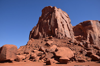
Monument Valley consists of towering sandstone formations that have been sculpted by the elements over time and rise between 400 to 1,000 feet above the valley floor. The park covers close to 92,000 acres and lies within the Navajo Nation reservation. It is most recognizable as being the backdrop for innumerable western movies and shows, beginning with many John Wayne films starting in 1939.

The following pictures are all from our jeep tour into the back country. 


And, of course, the now famous "Forrest Gump" scene, where he decides that he's tired of running and goes home!

From here, we were headed to Lake Mead Recreational Area, south of Las Vegas, Nevada. We were headed there to meet up with Steve and Joan Crowe, FOSJ, who were volunteering there for the winter. Looking at our possible routes there, we decided to drop down to I40 and stop in Flagstaff for the night. Contacting our good friends Steve and Teresa Heede, who we worked with in 2012 in Colorado and 2015 here at Luton's, they drove up from Mesa to visit with us for the evening. The best part about traveling across the country! You get to see all your RVing friends :-). 

From Flagstaff we arrived in Lake Mead the next day, and that, along with our visit to Death Valley National Park, will be the subject of the next journal entry. 

Thursday, June 7, 2018

Tent Rocks National Monument and Monument Valley

Please note: I don't know a cookie from a brownie. All I know is that they both are usually very tasty! If this site violates some EU law, decide whether to visit on your own. I can't figure it out... Yet.

Leaving Hot Springs, Arkansas, we had planned to just keep driving straight across the country on    I-40 to Albuquerque, where we planned on stopping just north of there in Bernalillo, New Mexico, for a couple of days. However, as I was casually flipping through some of the Facebook RV groups, I saw there were several wildfires in Oklahoma, some of which were actually close enough to I-40 to have it shut down in the western part of the state. Figuring that any detour out there would take us way out of the way, we changed up our plans and headed further south, dipping into eastern Texas on the way to Amarillo rather than Oklahoma. The halfway point in the drive ended up being only about 30 miles from Al's sister Susie, so it seemed like a great idea to stop and visit for the night. We had an impromptu, fun evening together at The Rib Crib, catching up and seeing our two nephews.

From there, we had another two days of driving and finally reached Bernalillo without incident. We stopped overnight in Amarillo, staying at the Oasis RV Park. We've stopped in several different campgrounds in Amarillo over the years, and we like this one for its easy access off the highway and easy parking for big rigs.

Once we got to Bernalillo, we stopped for three nights, just to have some down time off of driving, restock the pantry for the upcoming couple of weeks away from any large shopping areas, and to visit Kasha-Katuwe Tent Rocks National Monument. It's been on my radar for a while, but we've never actually made it there when we've been in the area. We stayed at the KOA North Albuquerque, which was very nice and convenient for the shopping we needed to do. Right next door, literally a few steps away, was the Kaktus Brewing Company. I was told by the girl checking me in that the pizza was quite good. Not being one who ever turns down a good pizza, we decided to take a break from cooking and give it a try. It was quite the funky little place, but the pizza was quite good, and folks around us having the local beer said it was very good as well. So give it a try if you're in the area.

Our first full day here, it was extraordinarily windy, which we came to discover would be a recurring theme throughout this spring trip. We used it as a "day off" from our touristy activities. We have found that during the periods where we are in travel mode, usually as we move from the east to the west and vice versa, that we really need to schedule in down days. It's tempting to not bother, as we are usually in an area we haven't been before and want to take in as much as we can, but it does become exhausting.  So we just "hang out," catch up on chores like laundry and shopping, and relax.

The next morning, we set off for our visit to Tent Rocks. It was about a 40-minute drive each way. I had checked the website for information and was glad I did so, for I saw that dogs are not permitted at this site. Most National Monument sites they are, so this surprised me a bit, but no problem. They are always happy and comfortable in the rig, so they went for their walk in the campground and settled in for a nap while we went out.

The drive there, once you leave I-25, actually goes through tribal lands, Cochiti Pueblo. After winding through the town area, past the reservoir, you make it to the BLM land that the monument sits on. The end of the road is where the trail starts. This was the description from the website of the hiking:
The national monument includes a national recreational trail. It is for foot travel only and contains two segments that provide opportunities for hiking, birdwatching, geologic observation and plant identification. Both segments of the trail begin at the designated monument parking area.

The Cave Loop Trail is 1.2 miles long, rated as easy. The more difficult Canyon Trail is a 1.5-mile, one-way trek into a narrow canyon with a steep (630-ft) climb to the mesa top for excellent views of the Sangre de Cristo, Jemez, Sandia mountains and the Rio Grande Valley. Both trails are maintained; however, during inclement weather, the canyon may flash flood and lightning may strike the ridges.

I was definitely planning on at least the Cave Loop Trail, ut wasn't sure about the other one. But we started out with a "let's see how it goes" attitude.

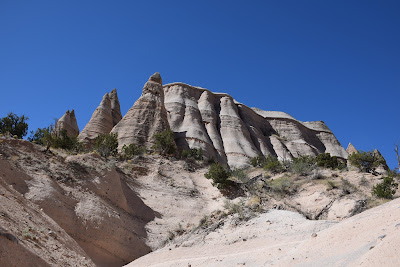
This is the beginning of the trail, with the massive formation ahead of us. You can see the cone-shaped formations that give this monument its name.


This starts the slot canyon section. The trail is very sandy.


The trail was pretty narrow as we were weaving throughout the conical rocks.

It's so interesting how the trees seem to hang on by a thread.

As we emerged from the narrow slot feature, the trail started winding it's way upward.


Different views as we kept going up. It was a perfect day for the hike.

This was about halfway up.


We kept on going and finally made it to the top of the overlook. I was very pleased with myself...I didn't even feel as if I were ready to drop! Losing some weight and getting more exercise is definitely making a difference in our stamina.


Different views of the rocks as we made our way down. Even on trails where it's not a loop, just an in-and-out trail, you get a different perspective of the view y coming from the opposite direction.


And back down at the base again. It was an absolutely gorgeous hike and a beautiful day. I highly recommend doing this if you are in the Albuquerque area. 


The next day, we continued our journey westward, heading to Monument Valley, on the Arizona/Utah border. And that will be the subject of the next entry! Thanks for reading :-).